So . . .where are we going?

EXHIBIT A: Your very own map of the state of Mississippi. The greenish area is the Mississippi Delta.* You might notice that the western border of the whole state is made up of the famed Mississippi River, fourth longest river in the world.
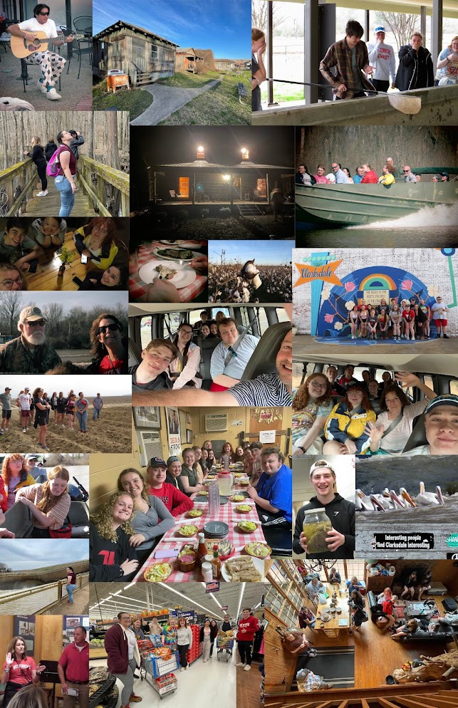
The towns listed here are some of those on our agenda for the week:
a) In the north central part of the state you'll see Oxford, home of the University of Mississippi (a.k.a. Ole Miss), but more importantly, the old stomping grounds of Richard Phillips, whose cabin (in nearby Batesville) we'll be staying in on our first two nights in the Magnolia State.
b) We'll be in Clarksdale on Monday night, where we have unique accommodations at the Shack Up Inn, a lodging facility made up of lots of one-time tenant farmer shacks which have been converted into comfortable (and memorable) places to stay.
c) We'll be staying in Greenville on Tuesday night. Note its proximity to Leland, former home of Wittenberg prof Catherine Waggoner.
d) Rolling Fork and Vicksburg are shown here because we'll be making trips there as well.
e) Jackson is the state capital, Memphis is the nearest seriously big city, and Cary is included because several Wittenberg students went there on community services trips with Professor Waggoner in 2012 and 2013.
*Which, unlike most river deltas, is NOT at the mouth of the Mississippi River. (So New Orleans is not in the Mississippi Delta, see?) (And, no, I'm not at all sensitive about this and all the times I've had to correct people who think they know what they're talking about!)
Comments
Post a Comment